We hope you enjoy this list of resources to further engage with the beautiful Berkshires!

Jump to: Field Guides & Books • Apps & Websites • Documentaries • Regional & County Maps for Purchase


Diversity, Equity, Inclusion, Access, & Belonging Resources:

Click here for a list of resources.


Conservation Networking Resources:

Click here for a list of Land Conservation, Management, Professionals, and Grant resources


BNRC’s Online LEARN Series:

Click here for educational online programs.


Hiking Resources:

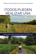
¡TODOS PUEDEN REALIZAR UNA CAMINATA!-PDF
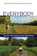
EVERYBODY CAN HIKE- PDF

The new Everybody Can Hike / Todos Pueden Realizar Una Caminata is a user-friendly resource to share information on what to bring, what to expect, and how to stay safe on the trails. 
CONDADO DE BERKSHIRE SENDEROS PARA TODOS-PDF
BERKSHIRE COUNTY TRAILS FOR ALL-PDF

The new accessible trails brochure, Berkshire County Trails for All / Condado De Berkshire Senderos Para Todos, was developed in response to needs suggested by community members and our partners, with the goal to create a resource both online and in print that can guide Berkshire residents and visitors to some of the accessible trails in the area. Each trail has a comprehensive description that gives enough information for a user to decide if it is a good fit for them before they visit.

MassWildlife’s Pocket Guide to MA Animal Tracks- PDF
Natural Community Fact Sheets– The Natural Heritage & Endangered Species Program
Day Hiking Checklist-REI
Wildflower Coloring Pages – US Forest Service


Backpack Programs:

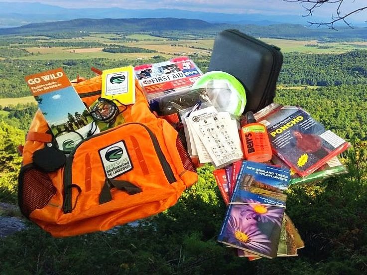
The programs provides access to essential hiking supplies for a safe, fun, and educational outdoor experience.

Borrow A Hiking Backpack at Pittsfield’s Public Library – Check out a backpack from the Berkshire Athenaeum, fully equipped with field guides, BNRC trail guides, a basic first-aid kit, a compass, binoculars, a magnifying glass, bug spray, two ponchos, and an observational journal.

Nature Discovery Backpacks at the North Adams Public Library-Community members with a library card are able to check out a backpack from the Youth Services Department equipped with field guides, trail suggestions, a basic first-aid kit, compass, binoculars, magnifying glass, bug spray, two ponchos, an insect house, wildlife tracking card, Leave No Trace educational cards, and an observational journal.


Other Naturalist Resources:

Recommended Field Guides:

  • The Sibley Field Guide to Birds of Eastern North America: Second Edition
  • Birds of Berkshire County by Bartlett Henricks
  • Exploring Stone Walls: A Field Guide to New England’s Stone Walls by Robert M. Thorson
  • Newcomb’s Wildflower Guide
  • Flora of Berkshire County Massachusetts by Pamela B. Weatherbee
  • Wildflowers of the Berkshire and Taconic Hills by Joseph G. Strauch
  • Woody Plants of the Northern Forest: A Photographic Guide by Jerry Jenkins
  • Kaufman Field Guide to Butterflies of North America
  • Peterson Field Guide to Moths of Northeastern North America
  • Common Mosses of the Northeast and Appalachians
  • Identifying Ferns the Easy Way: A Pocket Guide to Common Ferns of the Northeast by Lynn Levine
  • Mammal Tracks and Scat: Life-Size Tracking Guide by Lynn Levine
  • Mushrooms of the Northeast: A Simple Guide to Common Mushrooms
  • Peterson Field Guide to Ferns: Northeastern and Central North America, 2nd Edition
  • Bogs of the Northeast by Charles W. Johnson
  • MassWildlife Publications: (available to purchase here)
  • A Field Guide to the Amphibians and Reptiles of Massachusetts by Peter G. Mirick with Tom French and Jacob Kubel
  • Field Guide to the Animals of Vernal Pools by Leo Kenney and Matthew Burne
  • Field Guide to MA Dragonflies & Damselflies by Blair Nikula, Jennifer Loose, and Matthew
  • BurneGuide to Invasive Plants in Massachusetts

Recommended Books:

  • Braiding Sweetgrass: Indigenous Wisdom, Scientific Knowledge, and the Teachings of Plants by Robin Wall Kimmerer
  • Reading the Forested Landscape by Tom Wessels
  • Winter World: The Ingenuity of Animal Survival by Bernd Heinrich
  • Berkshire Forests Shade the Past by Bernard A. Drew
  • Exploring the Berkshire Hills: A Guide to Geology and Early Industry in the Upper Housatonic Watershed by Ed Kirby
  • Most Excellent Majesty: A History of Mount Greylock by Deborah E. Burns and Lauren R. Stevens
  • 50 Hikes in the Berkshire Hills by Laruen R. Stevens
  • The Hidden Life of Trees: What They Feel, How They Communicate―Discoveries from A Secret World by Peter Wohlleben
  • Eager: The Surprising, Secret Life of Beavers and Why They Matter by Ben Goldfarb

Recommended Apps/Websites:

iNaturalist App and Website – Record your observations. Share with fellow naturalists. Discuss your findings. Every observation can contribute to biodiversity science, from the rarest butterfly to the most common backyard weed. Your findings are shared with scientific data repositories to help scientists find and use your data. All you have to do is observe.

Merlin Bird ID App – Browse more than 8,000 stunning images taken by top photographers. Merlin also includes more than 3,000 audio recordings from the Macaulay Library, identification tips from experts, and range maps from the Birds of North America Online and Neotropical Birds.

eBird App and Website – Explore birds and hotspots near you and wherever you go, all based on the latest sightings from around the world. Share and keep track of your sightings!

Go Botany Website – Simple Plant ID Key

Northern Woodlands Website – The mission of the Center for Northern Woodlands Education is to advance a culture of forest stewardship in the Northeast and to increase understanding of and appreciation for the natural wonders, economic productivity and ecological integrity of the region’s forests.

Mary Holland’s Naturally Curious Website & Blog – Happenings around the fields, woods, and marshes of New England

Northern Forest Atlas Articles  Articles are short to medium-length, illustrated documents. Some,  are stand-alone pieces. Others are segments of running blogs.

Documentaries/Videos:

New England Forests Video Series

Kay Wood Documentary
The Dalton AT Community Members have created a short film to commemorate Kay Wood and her devotion to the Appalachian Trail. Kay Wood was a founding member for the Massachusetts AT Committee, a thru hiker, Dalton Community member, and avid trail volunteer

Native American Heritage Self Guided Walking Tour and Videos
The Native American Heritage Trail exists to provide accurate information about the Indigenous people of the region, and to enable visitors to explore the Housatonic River Valley while viewing it through a Native American prism. A program in partnership with the Stockbridge-Munsee Community, Band of Mohican Indians and the Upper Housatonic Valley National Heritage Area.


Regional & County Maps for Purchase

Berkshire County 50th Anniversary Wall Map

A stunning four-color wall map of Berkshire County is the most recent result of BNRC’s collaboration with cartographer Patrick Dunlavey. The map features public conservation land, along with roads, trails, topography and vegetative cover. Buildings and driveways are also shown, along with historic sites and other cultural features. The map will prove invaluable in any office, shop or storefront whose work relates in any way to regional geography. These utilitarian purposes are more than matched by the map’s high design standards and sheer beauty, making it suitable for hanging in any home.

The 32″ x 50″ map is available at the Arcadian Shop and other retailers in Berkshire County. BNRC has also contracted with a specialty New England framing company to have the map laminated and gallery mounted. The result is a durable, low-glare framing solution. Mounted maps are available at the above locations.


The “Green Series” Trail Maps and Interpretive Guides

The Berkshire Natural Resources Council believes that simply conserving land is not enough. We must also strive to make conserved land accessible. The Green Series was our effort to make public open space more accessible to the public by providing high quality maps and trail information that allow and encourage people to use and appreciate these lands. Each map has two sides printed in color. The map side includes trails, topography, shaded relief, forest cover, land ownership, and text descriptions of highlighted trails. The backside of each map is a guide to the natural and human history of the area. To date we have completed guides of Yokun Ridge, Mount Greylock, and the Southern Taconic Range.

Yokun Ridge

This map covers Yokun Ridge, the dominant land form of Central Berkshire. In this area the Berkshire Natural Resources Council has worked through land acquisition, trail construction, and advocacy to protect and connect land owned and managed by many different entities. These include the BNRC, Massachusetts Audubon Society, Massachusetts Department of Environmental Management, the Towns of Lenox, Stockbridge and West Stockbridge, the Mass Highway Department. In addition to the efforts made by the aforementioned groups, Yokun Ridge has been designated as a Forest Legacy Area by the U.S. Forest Service, which holds conservation restrictions on several parcels along the ridge. Some highlights on this map include Olivia’s Overlook, Stevens Glen, Pleasant Valley Wildlife Sanctuary, Kennedy Park, the Burbank Trail and Shadowbrook Reservoir.


 Mount Greylock

This map covers Mount Greylock and the conserved lands surrounding it. Greylock, the tallest mountain in Massachusetts, has a history as rich as its ecology. Spectacular views, remote boggy areas, alpine and boreal forests, and more than twenty rare and endangered plants grace its rolling peaks and ridgelines. Its tower-topped summit is a landmark for miles around and a defining characteristic of the Berkshire landscape. This guide details the flora and fauna found in the area as well as the long human history on the mountain. Highlights include: The Hopper, Mount Prospect, the Greylock Summit, Jones’ Nose, Stony Ledge, Sperry Campground, CCC Dynamite Trail, Money Brook, Robinson’s Point Trail, Deer Hill Falls Loop, Saddleball Mountain, Bascom Lodge, and Greylock Glen.


 South Taconic Range

South Taconic Range covers a large unfragmented forested highland at the junction of Connecticut, Massachusetts, and New York in the southwest corner of Berkshire County. This map unites on one page a remarkable human and natural landscape that falls within three states. The spectacular combination of exposed ridges and peaks, steep mountain streams, waterfalls, and superb natural history make this area a great hiking destination. The South Taconic Trail, Appalachian Trail, and numerous side trails provide access for both day and overnight hikes. Some highlights include Bash Bish Falls, Frissel Mountain (the highest point in Connecticut), Race Mountain, Bear Mountain, and Sages Ravine.

To Purchase Maps Visit:
BNRC’s Online Store OR
The Arcadian Shop, 91 Pittsfield Road Lenox, MA
The Bookloft, Barrington Plaza Rt. 7 Great Barrington, MA
Shaker Mill Books, 3 Depot St, West Stockbridge, MA