Regional & Berkshire County Maps
Printed Maps for Purchase
To purchase these beautiful, printed Berkshire County and regional maps, visit:
- The Arcadian Shop, 91 Pittsfield Road Lenox, MA
- The Bookloft, Barrington Plaza Rt. 7 Great Barrington, MA
- Shaker Mill Books, 3 Depot St, West Stockbridge, MA
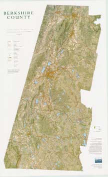
Berkshire County 50th Anniversary Wall Map
A stunning four-color wall map of Berkshire County is the most recent result of BNRC’s collaboration with cartographer Patrick Dunlavey. The map features public conservation land, along with roads, trails, topography and vegetative cover. Buildings and driveways are also shown, along with historic sites and other cultural features. The map will prove invaluable in any office, shop or storefront whose work relates in any way to regional geography. These utilitarian purposes are more than matched by the map’s high design standards and sheer beauty, making it suitable for hanging in any home.
The 32″ x 50″ map is available at the Arcadian Shop and other retailers in Berkshire County.
The “Green Series” Trail Maps and Interpretive Guides
Berkshire Natural Resources Council believes that simply conserving land is not enough. We must also strive to make conserved land accessible. Between 1999 and 2005, we created The Green Series maps in an effort to make public open space more accessible to everyone by providing high quality maps and trail information that allow and encourage people to use and appreciate these lands. Each map has two sides printed in color. The map side includes trails, topography, shaded relief, forest cover, land ownership, and text descriptions of highlighted trails. While the maps have not been updated since their original creation and may not reflect fully updated trail systems, the backside of each map is a guide to the natural and human history of the area.
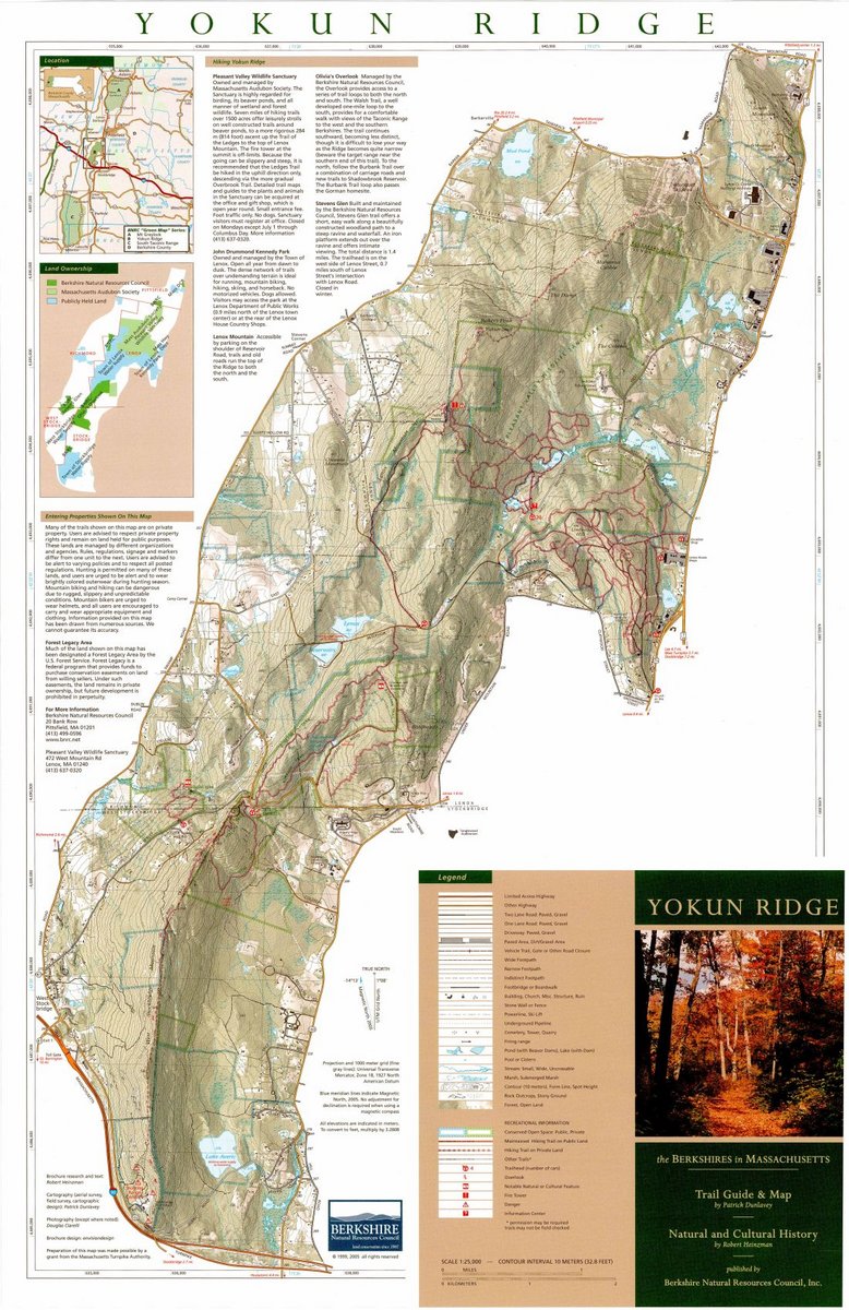
Yokun Ridge
This map covers Yokun Ridge, the dominant land form of Central Berkshire. In this area the Berkshire Natural Resources Council has worked through land acquisition, trail construction, and advocacy to protect and connect land owned and managed by many different entities. These include the BNRC, Massachusetts Audubon Society, Massachusetts Department of Environmental Management, the Towns of Lenox, Stockbridge and West Stockbridge, the Mass Highway Department. In addition to the efforts made by the aforementioned groups, Yokun Ridge has been designated as a Forest Legacy Area by the U.S. Forest Service, which holds conservation restrictions on several parcels along the ridge. Some highlights on this map include Olivia’s Overlook, Stevens Glen, Pleasant Valley Wildlife Sanctuary, Kennedy Park, the Burbank Trail and Shadowbrook Reservoir.
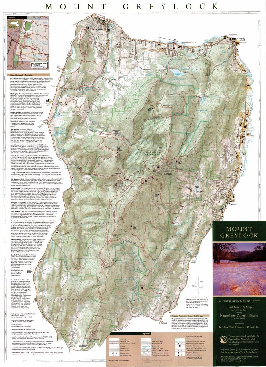
Mount Greylock
This map covers Mount Greylock and the conserved lands surrounding it. Greylock, the tallest mountain in Massachusetts, has a history as rich as its ecology. Spectacular views, remote boggy areas, alpine and boreal forests, and more than twenty rare and endangered plants grace its rolling peaks and ridgelines. Its tower-topped summit is a landmark for miles around and a defining characteristic of the Berkshire landscape. This guide details the flora and fauna found in the area as well as the long human history on the mountain. Highlights include: The Hopper, Mount Prospect, the Greylock Summit, Jones’ Nose, Stony Ledge, Sperry Campground, CCC Dynamite Trail, Money Brook, Robinson’s Point Trail, Deer Hill Falls Loop, Saddleball Mountain, Bascom Lodge, and Greylock Glen.
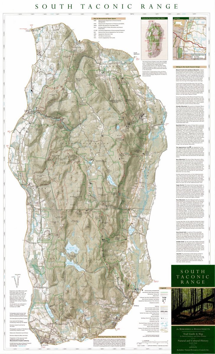
South Taconic Range
South Taconic Range covers a large unfragmented forested highland at the junction of Connecticut, Massachusetts, and New York in the southwest corner of Berkshire County. This map unites on one page a remarkable human and natural landscape that falls within three states. The spectacular combination of exposed ridges and peaks, steep mountain streams, waterfalls, and superb natural history make this area a great hiking destination. The South Taconic Trail, Appalachian Trail, and numerous side trails provide access for both day and overnight hikes. Some highlights include Bash Bish Falls, Frissel Mountain (the highest point in Connecticut), Race Mountain, Bear Mountain, and Sages Ravine.