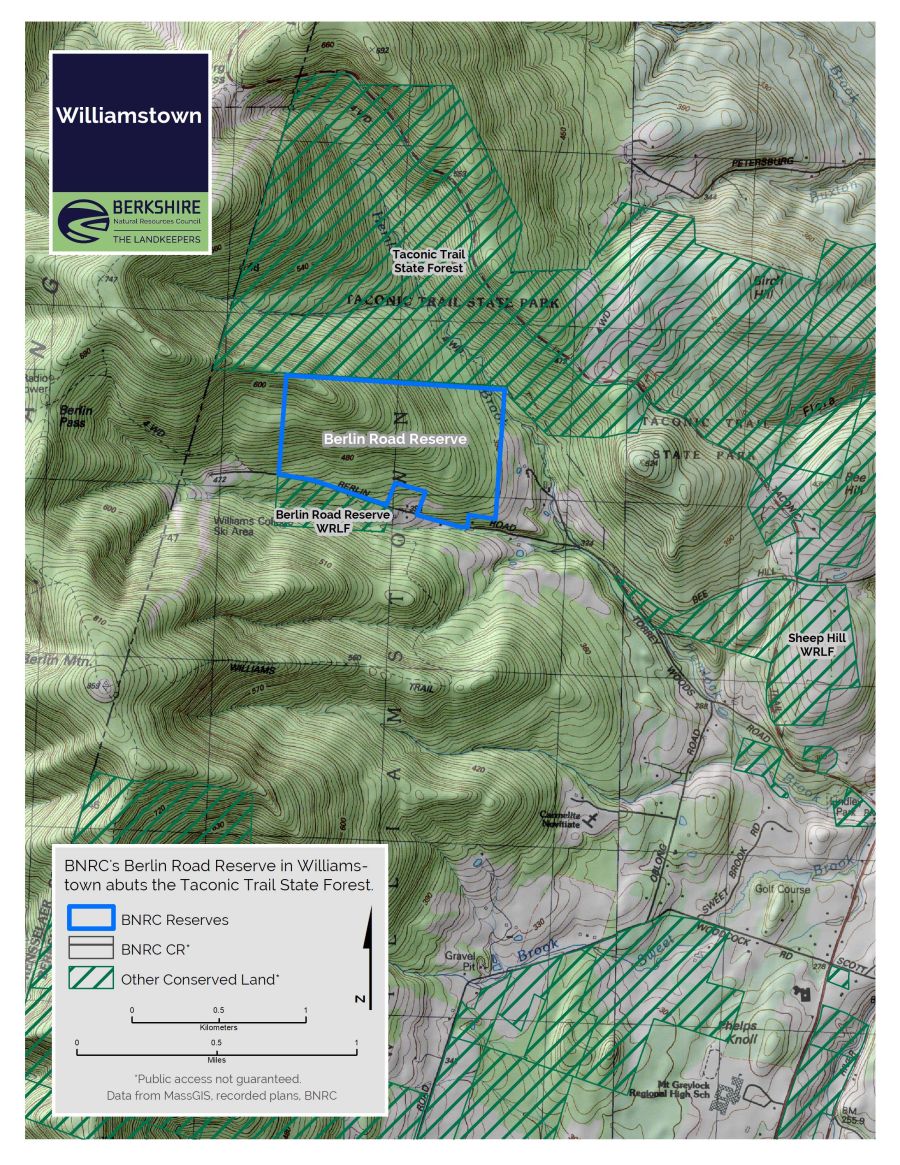
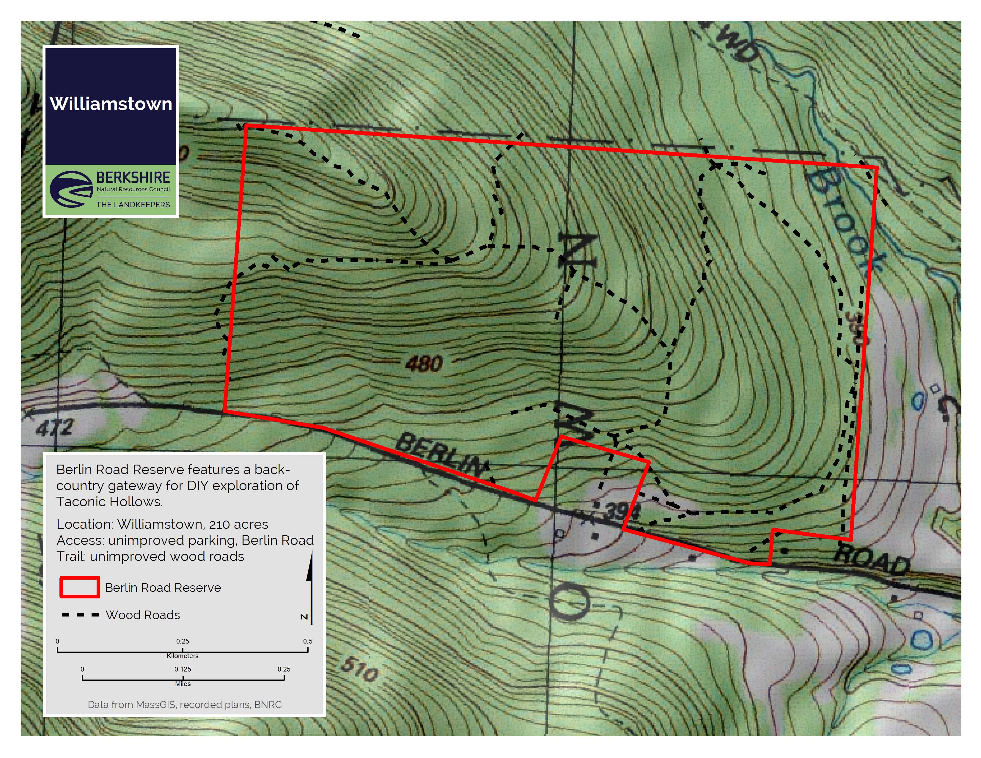
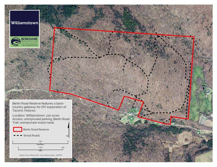
Berlin Road
A ridgeline property on the eastern slopes of the Taconic Range with unmarked wood roads. Outstanding starting point for exploration for explorers with map, compass, and GPS skills.
Highlights
- Williamstown, MA
- Difficulty: Difficult, unmarked trails, steep slopes
- Size: 210 acres
- Special features: Unimproved wood roads
Difficulty
This land, and all of the present-day Berkshires, are the ancestral homeland of the Mohican people, who were forcibly displaced to Wisconsin by European colonization. These lands continue to be of great significance to the Stockbridge-Munsee Mohican Nation today. To learn more, visit mohican.com.
Directions & Parking
GPS
- Frontage: Google Maps | 42.7012, -73.2637
From Williamstown
From the intersection of Route 2 west and Route 7, head west on Route 2 for 0.3 miles to a left on Torrey Woods Road. In 0.4 miles, bear right at the intersection with Berlin Road. Follow Berlin Road for 1.3 miles to the unmarked pull-off on the right. Or continue farther west on Berlin Road to the trailhead for the Class of ’33 trail.
About the Reserve
This is the planned jumping off point for a proposed ridgeline trail intersecting with the Taconic Crest Trail north of Berlin Road, as well as the Sarah Tenney Trail – part of a larger vision for this beautiful bowl straddling the NY/MA state line. For now, you’re free to explore the hollows and ridgeline on your own.